Build Your Dream
Elucidate Technologies Pvt. Ltd
Elucidate Technologies Pvt. Ltd. Has Unmatched Capability To Offer Various Solution To The Clients/Partners On Their Service Needs Related To Navigation Data Analytics, GIS, LIDAR, Mobile Mapping, Orthophoto, Photogrammetry, BIM & Engineering Solutions.
Build Your Dream
5 Years Of Undefeated Success
The company is registered and started executing projects in the year 2018 however incorporated as Pvt. Ltd. in 2021.
40+
Successfully Project Finished.
5+
Years of experience with proud
Build Your Dream
Quality Services
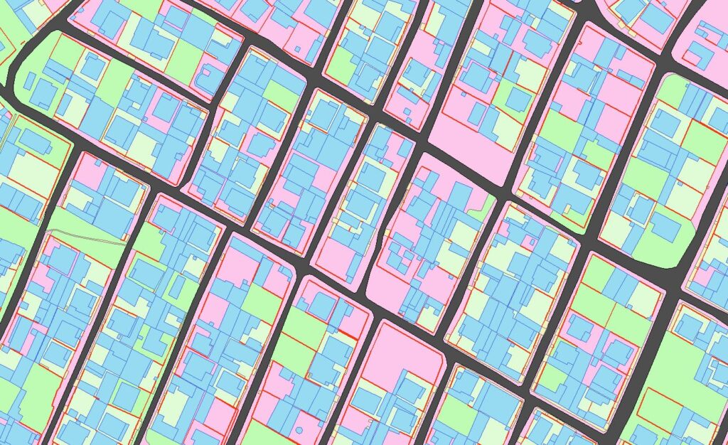
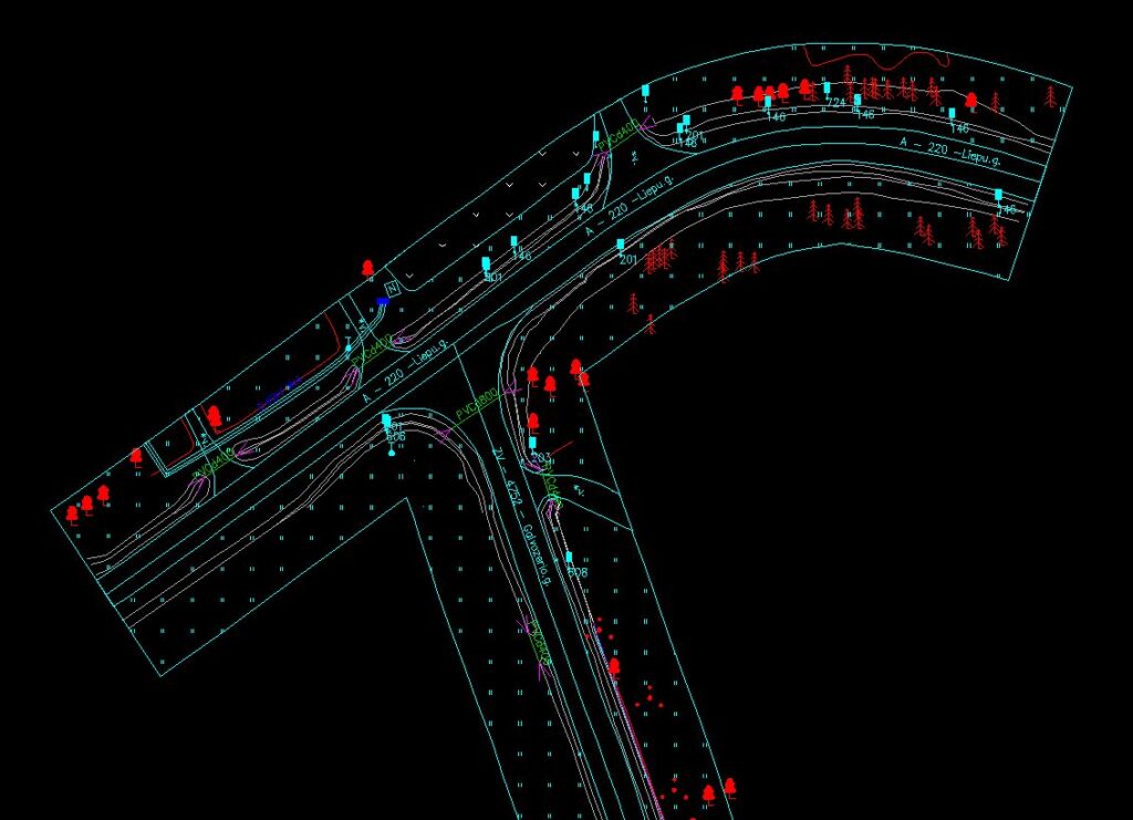
In the strictest sense, a GIS is a computer system capable of assembling, storing, manipulating, and displaying geographically referenced information, i.e., data identified according to their locations.
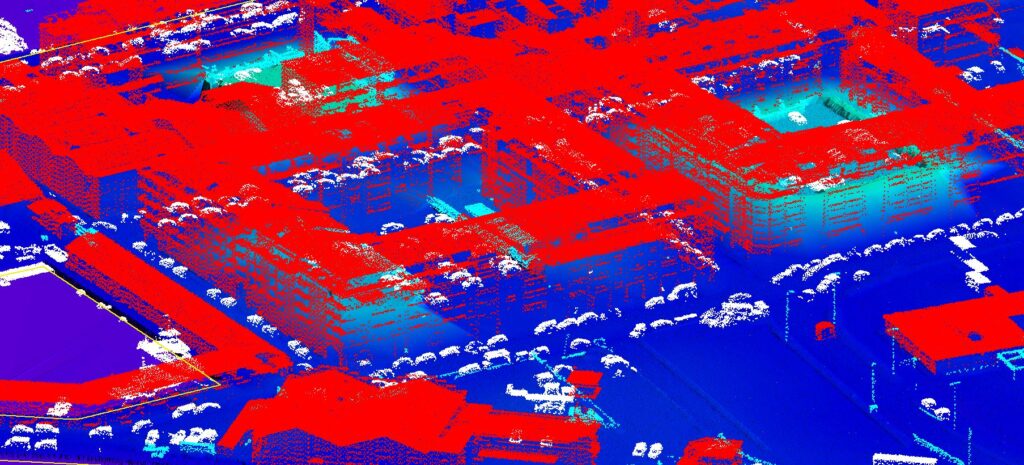
Light detection and Raning Or ‘Lidar’ is an Active Remote Sensing Technique that is used to gather spatial data. In it’s most basic form , Lidar uses a Laser and a Sensor to determine the Distance between an object and the lidar system
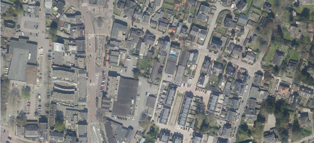
An orthophoto is an aerial photograph that has been geometrically corrected or ‘ortho-rectified’ such that the scale of the photograph is uniform and utilised in the same manner as a map.
photogrammetry is a well-established technique for acquiring dense 3D geometric information for real-world objects from stereoscopic image overlap and has been shown to have extensive applications in a variety of fields
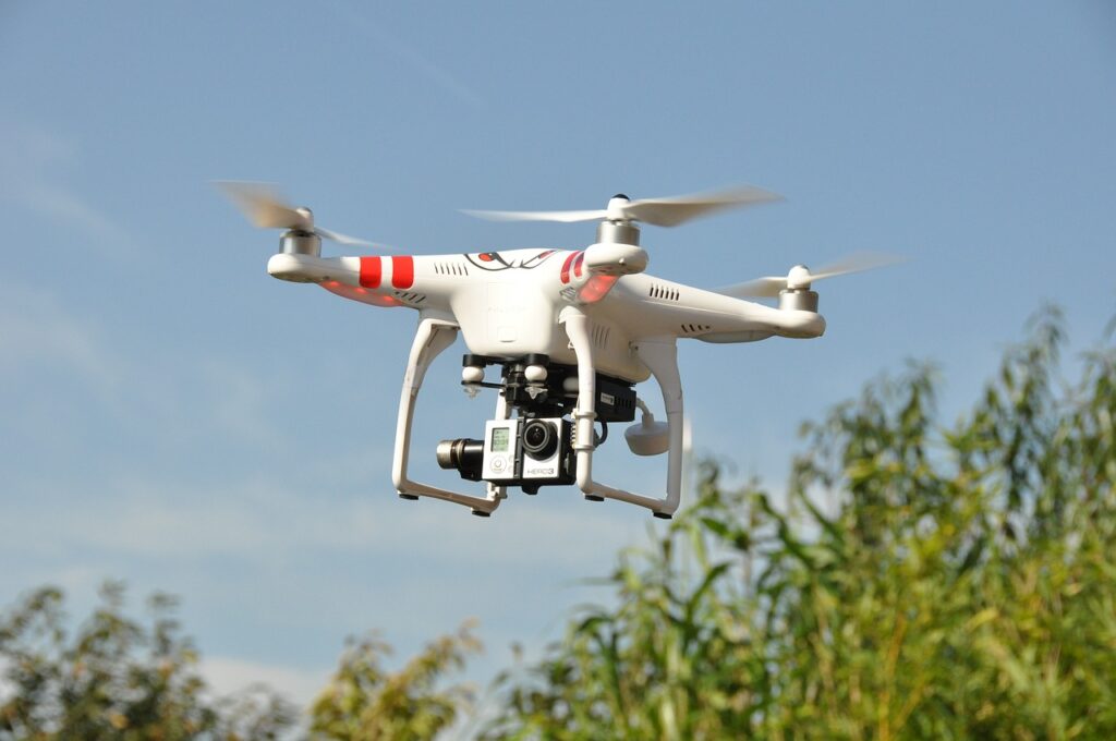
Drone services, also known as unmanned aerial vehicle services, is the emerging market for services built around flying robots that can be remote-controlled or flown autonomously using software-controlled flight plans in their embedded system.
Mobile LiDAR System is an emerging technology that combines multiple sensors. Active sensors, together with Inertial and Global Navigation System, are synchronized on a mobile platform (car, train, boat, etc.) to produce an accurate and precise geospatial 3D point cloud.
Committed To Keep People Safe
Elucidate Technologies Pvt. Ltd put forward innovative ideas and use new technology. We offer a wide range of survey services.
Why Elucidate Technologies ?
Ready for a world-class technical experience? Elucidate Technologies is here to help! With our cost-effective solutions, cutting-edge technology, and highly committed team, we’ll make sure you get the best products with unbeatable service. Plus, our on-time and secure delivery ensures your data is always protected – so you know you can trust us for all your technology needs. Join us now and see why Elucidate Technologies is the perfect choice for you!
- Work In All Environments
- Project On Time
- Modern Technology
- Latest Designs
About Founders
Our Latest Works
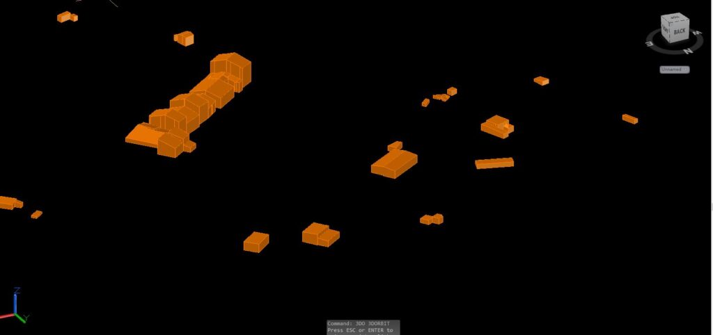
GIS Activities
Mobile Laser
Lidar Services
Drone Services
Request a Quote
Learn More From
Frequently Asked Questions
A geographic information system (GIS) is a computer system for capturing, storing, checking, and displaying data related to positions on Earth’s surface.
Airborne laser scanning, or ALS, is simply LiDAR data collection from an aircraft while it is in the air. If the LiDAR scanner is mounted on a tripod, the method is known as Terrestrial Laser Scanning or TLS.
- Orthophotographs are photographic images constructed from vertical or near-vertical aerial photographs. The processes used to generate orthophotos remove theeffects of terrain relief displacement and tilt of the aircraft.